
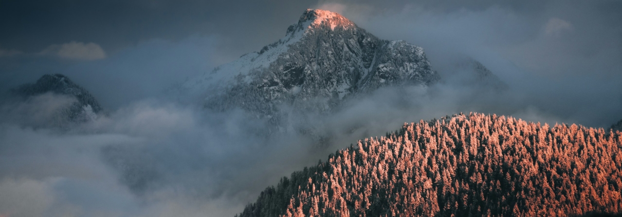
Most people outside North Vancouver hear “Seymour” and picture the ski hill. Buyers who live here mean something wider: the whole east side of the District of North Vancouver, from the Seymour River across to Indian Arm.
It is the District’s most varied corner. One street gives you a 1960s split-level a short walk from a rec centre. The next gives you a 1990s house backing onto forest, or a new apartment beside a working industrial road.
That variety is the point, and it is also the risk. The commute, the hazard rules and what you are allowed to build change street by street. This guide sets out what the District of North Vancouver, Metro Vancouver, BC Parks, the school district and TransLink actually publish, with dates and links, so you can check any of it yourself.
The short version
- “Seymour” is the District of North Vancouver’s name for the east side: Maplewood, Seymour Heights, Windsor Park, Northlands, Parkgate, Dollarton and Roche Point, with Blueridge and Deep Cove alongside.
- City hall is the District of North Vancouver, not the City. Different rules, different counter, different phone number.
- Maplewood is the one part of Seymour planned for real growth. Council approved a plan in 2017 and a 534-unit mixed-use project in 2024.
- Much of the housing sits on slopes, beside creeks or against forest. The District runs hazard development permit areas over that land, and they decide what you can build.
- On 13 April 2026 District Council passed a motion not to support small-scale multi-unit housing as required by the Province’s Bill 25. That is unsettled, so check before you plan a multiplex.
- Transit changed on 7 September 2026. The R2 RapidBus now runs all day through Phibbs Exchange, which is where every Seymour bus connects.
- Green space is why most people stay: a 5,668-hectare conservation reserve, a provincial park and a conservation area on the inlet, all within a few minutes’ drive.
On this page
- Where Seymour is, and which city hall you deal with
- How the area grew, from a sawmill to a village centre
- The pockets, and how they differ
- What kind of money Seymour is, and what moves it
- The housing stock by era, and what goes wrong in it
- Slope, creek and wildfire rules: the part that catches buyers out
- What to check before you buy here
- Daily life: Parkgate, Maplewood and the shops
- Parks, trails and the mountain
- Schools, and why you must confirm the catchment
- Getting out: buses, the bridge and the new RapidBus
- What is being built and planned
- How many homes you can put on a lot right now
- What people like, and what they complain about
- Who Seymour suits, and who should look elsewhere
Where Seymour is, and which city hall you deal with
Seymour is everything east of the Seymour River in the District of North Vancouver. Mount Seymour Parkway runs through the middle of it. Dollarton Highway runs below, closer to the water.
This matters more than it sounds. There are three local governments on the North Shore: the City of North Vancouver, the District of North Vancouver and the District of West Vancouver. Seymour is entirely in the District.
So the bylaws, the permit counter, the hazard maps and the tree rules are the District’s. The District’s own neighbourhood list names both Seymour and Maplewood as areas.
Before you rely on anything municipal in this guide, call or email them. Rules, maps and fees change without much notice. The District of North Vancouver is at 355 West Queens Road, North Vancouver, on 604-990-2311, or infoweb@dnv.org. Planning questions go to the Community Planning Department on 604-990-2480 or communityplanning@dnv.org.
How the area grew, from a sawmill to a village centre
The name comes from Frederick Seymour, Governor of the Colony of British Columbia from 1864 to 1869. BC Geographical Names records the river as “Seymour Creek” from 1917, with the name changed to Seymour River on 6 May 1947. BC Parks says the provincial park was established in 1936 and named for the same man.
The settlement story starts with lumber. MONOVA, the Museum and Archives of North Vancouver, records that in 1917 “San Francisco lumber man Robert Dollar opens the Dollar Mill near the mouth of Indian Arm,” and that the mill closed in 1942. The community of Dollarton grew around it, and the name is still on the highway.
Getting off the North Shore shaped everything else. MONOVA dates the first Second Narrows Bridge to 7 November 1925. A partly built replacement collapsed into Burrard Inlet on 17 June 1958, killing workers; the Province puts the toll at 19. The new bridge opened on 25 August 1960 and was officially renamed the Ironworkers Memorial Second Narrows Crossing in 1994.
That bridge is why most of Seymour’s housing exists. Suburban streets filled in behind it through the 1960s and 1970s, and again in the 1990s further up the hill.
Maplewood took a different path. MONOVA records that squatters were living in shacks on the Maplewood mudflats when local government moved to evict them in 1971. The flats are now a conservation area; the land behind them became industrial, and is now being rebuilt as a village centre.
The pockets, and how they differ
Seymour is not one neighbourhood. Treat it as six or seven, because the prices, the ages of the houses and the walk to a shop are different in each.
Maplewood: the flat, changing, working end
Maplewood sits on the flat land between the Seymour River and the inlet, either side of Dollarton Highway. It is the only part of Seymour with heavy industry as a neighbour, and the only part with new apartments going up.
The District’s own description is blunt about the mix. It names “business parks” along Dollarton, and further south “industrial lands that include our regional transfer station and recycling depot, shipbuilding, and other manufacturing businesses.” Buyers who want quiet should walk the site at a weekday hour, not a Sunday.
Seymour Heights and Windsor Park: the 1960s middle
These two sit on the slope above Mount Seymour Parkway, roughly between Berkley Road and Mount Seymour Road. The housing is mostly detached, mostly built in the decade or two after the bridge opened, on generous lots with mature trees.
Windsor Secondary sits in Windsor Park and gives the area its name. This is the part of Seymour where you are most likely to find an original house that has never been renovated, and the part where the slope rules bite hardest.
Northlands and Parkgate: the 1990s planned end
Higher up, around Mount Seymour Road and Anne Macdonald Way, the streets are newer and the layout is deliberate. Northlands is built around the golf course. Parkgate is the area’s service hub, with the community centre, the library and the shops in one place.
This is where you find townhouses, newer detached houses and purpose-built seniors’ housing close together. It is also the highest and the coldest part of Seymour in winter.
Dollarton and Roche Point: the water side
Below Mount Seymour Parkway, toward the inlet, the streets around Roslyn Boulevard, Dollar Road and Beachview Drive run down toward the water. Lots are larger, several houses are older, and a few have water views.
Cates Park is the anchor here, and the walk to it is the reason many people buy on this side. This is also the oldest-settled part of Seymour, because it is where the mill was.
Blueridge and Deep Cove: next door, and different
Blueridge sits against the forest above the Parkway, and Deep Cove is at the far eastern end. Both are usually counted with Seymour and both deserve their own treatment. There are separate guides to Blueridge and Deep Cove.
What kind of money Seymour is, and what moves it
Seymour is the part of the District where a family buying a detached house has the widest range of options. It is generally less expensive than the west side of the District, and less expensive than Deep Cove at the end of the same road.
Within Seymour the spread is wide. An original 1960s house on a slope in Seymour Heights and a new townhouse in Northlands are not in the same market at all. Apartments in Maplewood open the area to buyers who could not consider a house here.
I do not print price figures in an area guide, because they date within weeks. The current benchmarks for North Vancouver, updated with each monthly release from Greater Vancouver REALTORS, are on my North Shore market statistics page.
What actually moves a price on a given Seymour street:
- Whether the lot is flat. A flat, buildable lot is worth noticeably more than a steep one, because of what you can do with it later.
- Which hazard permit areas cover it. A slope or creek designation adds engineering reports and time to any project.
- The walk to Parkgate. Being able to reach the shops, library and community centre on foot is the single most repeated request from buyers here.
- Which side of the Parkway. Above it you get more trees and more slope. Below it you get flatter land, and closer to Dollarton, more traffic and industry.
- The state of the house. A large share of Seymour’s detached stock is now 50 to 65 years old, and buyers price the deferred work.
The housing stock by era, and what goes wrong in it
Seymour’s housing falls into three broad waves. Knowing which one a house belongs to tells you most of what an inspector will find.
1960s and 1970s: split-levels and basement-entry houses
This is the bulk of Seymour Heights, Windsor Park and much of Dollarton. Expect single-pane or early double-glazed windows, original drainage, and a roof that has been replaced once or twice.
Two items matter more here than almost anywhere on the North Shore. The first is a buried oil tank, common in houses of this age that were heated with oil before gas arrived. The second is perimeter drainage, because these houses sit on slopes that shed a great deal of winter rain.
1980s and 1990s: larger detached houses and the first townhouses
Northlands and the upper Parkgate streets are mostly this era. The houses are bigger, better insulated and easier to finance, but they are now old enough for their own list.
Ask about the building envelope on anything with stucco from this period, ask when the decks were last waterproofed, and ask what the plumbing is. There is a fuller list in what to check in an older North Shore home.
2000s onward: apartments and townhouses, mostly in Maplewood and Parkgate
Newer strata buildings behave like newer strata buildings anywhere: read the depreciation report, read the minutes, and look at the contingency reserve fund before you look at the finishes.
For anything strata, my article on strata depreciation reports explains what to read first. For any house, the District keeps permit records, and checking the permit history is worth an afternoon before you write an offer.
Slope, creek and wildfire rules: the part that catches buyers out
This is the single biggest difference between buying in Seymour and buying on flat ground elsewhere in Metro Vancouver, and most listing copy never mentions it.
The District explains on its own hazardous areas page that “steep slopes, creeks, ravines, floodplains and forested lands — combined with occasional extreme weather activity — make some areas of the District susceptible to natural hazards including landslide, debris flow, flood and wildfire.” It manages this through Development Permit Areas, which are map overlays that add requirements to building or altering land.
Seymour sits at the sharp end of that. The District’s Living close to steep terrain page dates its current approach to a landslide on Berkley in 2005, on this side of the District. It records a Natural Hazards Task Force in 2007, risk tolerance criteria adopted in 2009, a United Nations Sasakawa Award in 2011 — “the first awarded to a Canadian community” — and a Slope Hazard Development Permit Area added to the Official Community Plan in 2012.
In practice, that means three questions for any Seymour property:
- Is the lot in the Slope Hazard DPA? If it is, building or altering the land can need a permit and a geotechnical report.
- Is it in the Creek Hazard DPA? Several creeks run down through Seymour to the inlet, and the setbacks are real.
- Is it in the Wildfire Hazard DPA? The forest edge above the Parkway is exactly the land this covers.
Do not try to read coverage off a map yourself. Look up the specific address in the District’s GeoWeb property viewer, then confirm what you find with the District before you rely on it.
Two practical details from the same District page. Adding or removing more than 20 cubic metres of fill needs a Soil Permit. And if you see signs of instability on a slope, the District’s Engineering Department is on 604-990-2450 or engineering@dnv.org.
What to check before you buy here
This is the list I work through on a Seymour property. None of it is exotic; all of it is specific to this side of the District.
| What to check | Why it matters here | Where to check it |
|---|---|---|
| Which hazard permit areas cover the lot | Slope, creek and wildfire overlays run across a lot of Seymour’s residential land and control what you can build | District GeoWeb property viewer, then confirm with the District, 604-990-2311 |
| How many homes the lot allows today | The District allows a house, suite and coach house inside the urban containment boundary; the four-to-six-unit rules are unsettled | Community Planning, 604-990-2480, communityplanning@dnv.org |
| What is approved or applied for nearby | Maplewood is a designated growth area, so a low building next door is not a permanent condition | The District’s development applications map |
| The school catchment for that exact address | Catchments change, and the English and French Immersion catchments are not the same | School Locator, then call the school district |
| The real bus time, from that stop, at your hour | Travel time downtown varies by roughly an hour depending on where you start and when you leave | TransLink trip planner, for your actual departure time |
| Whether there is, or was, a buried oil tank | Common in Seymour’s 1960s and 1970s houses, and expensive to deal with after completion | A tank scan, plus this guide |
| Drainage, fill and retaining walls on a sloping lot | Winter rain is the main cause of trouble, and more than 20 cubic metres of fill needs a Soil Permit | A home inspector, a geotechnical engineer, and District Engineering, 604-990-2450 |
Daily life: Parkgate, Maplewood and the shops
Seymour does not have a high street in the way Edgemont or Deep Cove does. It has two service clusters instead, and most daily life happens at one of them.
Parkgate: the community centre, the library and the shops in one place
Parkgate is at Mount Seymour Parkway and Mount Seymour Road. It is the practical centre of the area, and it is the reason many families choose the upper streets.
Parkgate Community Centre is at 3625 Banff Court, on 604-983-6350. North Vancouver Recreation and Culture lists a gymnasium with 8 badminton and pickleball courts, 2 full basketball courts, 3 volleyball courts and a climbing wall, plus a fitness centre, a pottery studio and rooms for rent. It opens at 6am on weekdays. There is no swimming pool at this location.
Parkgate Library is next door at 3675 Banff Court, on 604-929-3727. North Vancouver District Public Library lists it open 10am to 6pm on Monday, 10am to 8pm Tuesday to Thursday, and 10am to 6pm Friday to Sunday, with a quiet study room and a teen space.
The shops sit in the same small cluster, so if you are used to walking to everything, this is the pocket to look at first. Shops change hands, so walk it yourself before you decide it has what you need.
Maplewood: a village centre being built around a farm
The District describes Maplewood Village Centre as “gently growing” with a “unique selection of shops and services,” between Old Dollarton Road and Dollarton Highway, west of Riverside Drive.
Its best-known attraction is Maplewood Farm at 405 Seymour River Place, on 604-929-5610, open daily 10am to 4pm and operated by the District of North Vancouver’s Parks Department. It is a working small farm you can walk into, and for families with young children it is a weekly habit rather than a day trip.
Maplewood also now has its own fire hall. The District records that firefighters responded to their first call from the new Maplewood Fire and Rescue Centre on 15 January 2025, and that it is built to post-disaster standards so it can serve as a command centre in a larger incident.
Parks, trails and the mountain
If there is one reason people put up with the commute, it is this. Seymour has more protected land on its doorstep than any other residential area on the North Shore.
Lower Seymour Conservation Reserve: 5,668 hectares at the top of the road
Metro Vancouver describes the Lower Seymour Conservation Reserve as “a 5,668-hectare protected area in North Vancouver.” Its management plan says the reserve “opened to the public in 1987 to encourage education and recreation opportunities,” and that the Seymour water supply area and reservoir “provides approximately one third of the region’s water supply.”
The same plan records 65 kilometres of trail access for dog walking, with dogs permitted on trails south of the Rice Lake Gate and on the Homestead Trail, and commercial dog walking not permitted. Rice Lake itself is the easy, flat, family walk most locals start with.
Mount Seymour: a provincial park and a ski hill at the end of the road
Mount Seymour Provincial Park was established in 1936 and holds 14 hiking trails. BC Parks warns that “the mountainous backcountry is extremely rugged” and that “weather can change suddenly,” and notes that free day-use vehicle passes may be required in winter.
Mt Seymour Resort, at 1700 Mount Seymour Road, is the ski area inside the park. One detail matters if you live here: the resort runs shuttle buses “from both East Vancouver and Parkgate Community Centre.” A Parkgate household can send a teenager up the mountain without driving them.
Maplewood Flats: a conservation area on the inlet
The Wild Bird Trust of British Columbia manages the conservation area at Maplewood Flats. It describes “a 96 hectare intertidal area composed of mudflats and salt marsh” and “a 30 hectare upland area,” and records that District of North Vancouver Council officially created the conservation area in 1989.
The Trust says the site has over 3 kilometres of wheelchair-accessible trails and roughly 33,000 visitors a year, with free admission. It is five minutes from Maplewood’s new apartments, and it is the kind of place people use weekly rather than once.
Cates Park, Northlands and the everyday green space
Cates Park on the Dollarton waterfront is the area’s swimming, picnic and boat-launch park. Seymour River Heritage Park sits beside Maplewood Farm. Smaller District parks are scattered through every pocket.
Northlands Golf Course at 3400 Anne Macdonald Way is public, designed by Les Furber, and says it “opened for play on October 7, 1996.” The houses around it were built to face it.
Schools, and why you must confirm the catchment
Seymour is served by the North Vancouver School District, School District 44. These are the schools in and around the area, with the details published by the district itself.
- Seymour Heights Elementary, 2640 Carnation Street, 604-903-3760. Runs the district’s Elementary Band and Strings programme.
- École Dorothy Lynas Elementary, 4000 Inlet Crescent, 604-903-3430. Kindergarten to Grade 7, English and French Immersion, close to 550 students.
- École Sherwood Park Elementary, 4085 Dollar Road, 604-903-3810. Kindergarten to Grade 7, English and French Immersion, about 400 students.
- Cove Cliff Elementary, 1818 Banbury Road, 604-903-3420. Kindergarten to Grade 7.
- Blueridge Elementary, 2650 Bronte Drive, 604-903-3250.
- École Windsor Secondary, 931 Broadview Drive, 604-903-3700. Grades 8 to 12, with French Immersion.
- Seycove Secondary, 1204 Caledonia Avenue, 604-903-3666.
Two things are worth knowing before you choose a street for a school.
First, the English and French Immersion catchments are different. The district states that Dorothy Lynas is “part of the Seycove (English) and Windsor (French Immersion) Secondary School catchment areas,” and Sherwood Park’s plan says its French Immersion students attend Windsor while its English students attend Seycove. Cove Cliff’s page names Sherwood Park, Dorothy Lynas and Cove Cliff as feeding Seycove.
Second, the secondaries run different programmes. The district’s secondary programmes letter lists a Basketball Academy and a Performance Learning Program at Seycove, and a Dance Academy, Hockey Skills Academy, Soccer Academy and an entrepreneurship programme at Windsor. Neither school runs International Baccalaureate or Advanced Placement; those are at other North Vancouver secondaries.
Confirm the catchment for the exact address before you buy. Catchments are redrawn, and a street can change schools between one year and the next. Use the School Locator and then telephone the school district on 604-903-3444 to confirm what it tells you.
Getting out: buses, the bridge and the new RapidBus
Seymour has one significant weakness, and this is it. Almost everyone leaving the area funnels onto Mount Seymour Parkway or Dollarton Highway and then over the Ironworkers Memorial Second Narrows Crossing.
The buses: four routes, all of them through Phibbs Exchange
Four TransLink routes serve the area. The 211 runs Seymour to Phibbs Exchange to Burrard Station. The 212 runs Deep Cove to Phibbs. The 214 runs Blueridge to Phibbs and on to Burrard Station. The 215 runs Indian River to Phibbs.
Mount Seymour Parkway is served by all four. Dollarton Highway is served by the 211, 212 and 215.
How long it actually takes to reach downtown
On TransLink’s September 2026 timetable for the 211, weekday westbound, the scheduled run from Panorama at Naughton to Burrard Station is 50 to 65 minutes. The earliest through trip of the day is the fastest at 50 minutes. The afternoon peak is the slowest at 65.
Starting from the Parkway instead of the far end cuts that. From the Seymour Parkway at Mount Seymour stop, the same trips are scheduled at roughly 40 to 55 minutes to Burrard Station.
Direct downtown service is limited. On the 211 the weekday through trips run from roughly 6.23am to about 5.17pm from Panorama. The 214 has at least one direct weekday morning trip from Blueridge, leaving Sechelt at Hyannis at 6.52am and reaching Burrard Station at 7.37am. The 212 and 215 do not go downtown at all; both end at Phibbs.
Check your own stop and your own departure time on the TransLink trip planner. Timetables change, and these are scheduled times rather than what happens in heavy traffic.
What changed on 7 September 2026, and why it matters here
This is new enough that most guides to the area have not caught up. On 7 September 2026 TransLink extended the R2 Marine-Willingdon RapidBus from Phibbs Exchange through to Metrotown Station.
TransLink says the extended R2 “runs every six to seven minutes during peak periods” and “operates from 5 a.m. to 2 a.m. seven days a week,” replacing the peak-only 222 Express.
Every Seymour bus route ends or passes through Phibbs Exchange. So for a Seymour household, the practical effect is a frequent all-day connection west to Lower Lonsdale and Park Royal, and east across the bridge to Brentwood, BCIT and Metrotown, without waiting for an hourly bus.
If your work is on the SkyTrain network rather than in downtown Vancouver, Seymour’s transit just became a considerably better proposition than the 211’s timetable alone suggests.
What is being built and planned
Almost all of Seymour’s planned change is in Maplewood. The rest of the area is built out, and the District’s growth policy points development at village and town centres rather than at established streets.
Council approved the Maplewood Village Centre and Innovation District Implementation Plan on 6 November 2017. The plan area is “approximately 80 hectares (198 acres),” bounded by the Seymour River to the west, Mount Seymour Parkway and the Windridge escarpment to the north, Blueridge and McCartney Creeks to the east, and the light industrial areas south of Dollarton Highway to the south.
What the plan sets out, in its own words:
- “Roughly 1,500 new residential units are planned” in the Village Centre.
- “900 residential units are contemplated in the Innovation District” to the north.
- A target of “up to 300 net new non-market housing units in the Maplewood Village Centre.”
- Most buildings at three to six storeys, but “taller buildings (up to a maximum 12 storeys) may be permitted in the Village Centre on a case by case basis.”
- An extension of Berkeley Road “to connect Mount Seymour Parkway with Dollarton Highway.”
That plan is now producing buildings. The District’s Maplewood page records that in 2024 Council approved a five-storey mixed-use development with 534 new units and commercial space, adding public plazas, retail, pedestrian pathways, bike lanes and a rapid transit stop.
The same page records that Metro Vancouver Housing has announced a family-oriented, non-market rental project on District-owned land at Riverside Drive along Old Dollarton Road, for families, seniors and people with disabilities.
If you are buying in or near Maplewood, look up what is proposed on the block before you commit. The District keeps a live map of significant development applications, searchable by address, and a separate map of construction projects that affect traffic.
How many homes you can put on a lot right now
This is the most misunderstood question in the District at the moment, and the answer in Seymour is not the same as in the rest of Metro Vancouver.
Since June 2024, the District has allowed three units — a house, a secondary suite and a coach house — on single-family lots inside the urban containment boundary. That came from Bylaw 8698, which the District says permits an additional 17,000 dwelling units across its single-family neighbourhoods, “a 40% overall increase.”
The Province then went further. The District’s provincial housing legislation page, updated 23 April 2026, explains that “Bill 25 requires the District to increase density in these traditional single-family areas by allowing up to four to six units per lot in the form of small-scale multi-unit housing.”
The District has not gone along with it. The same page records that “at a meeting held April 13, 2026, Council passed a motion to not support the implementation of SSMUH in the District as implied in Bill 25.”
Seymour is central to why. The District states that “approximately 7,000 lots in the District are situated in natural hazard areas — near steep slopes, creeks, and forests — where wildfire and flooding risks are elevated,” and that it considered hazard-related exemptions for those lots. A great deal of Seymour’s residential land is exactly that kind of land.
So do not assume a four-unit or six-unit project is possible on a Seymour lot. This is live, it is contested between a municipality and the Province, and it may look different in six months.
If density is your reason for buying, ask Community Planning about that specific address before you write an offer, on 604-990-2480 or communityplanning@dnv.org. I have written a fuller explanation in how many homes you can build on a North Vancouver lot.
What people like, and what they complain about
An honest guide has to carry both. Here is what comes up on each side.
What people like
- The amount of protected land within a few minutes’ drive, and the fact that it is public and free.
- Parkgate, where the community centre, library and shops sit together.
- Bigger lots and more trees than you get for the same money nearer the water on the west side of the District.
- Maplewood Farm, the flats and Cates Park, which make it an easy area for young children.
- A mountain with a shuttle from the community centre.
What people complain about
- The bridge. Almost every trip off the North Shore from Seymour goes over the Ironworkers crossing, and when it is bad there is no second option nearby.
- The direct bus downtown is thin. Weekday through trips on the 211 stop in the late afternoon, and two of the four routes do not go downtown at all.
- The industrial edge at Maplewood. The District’s own description names the regional transfer station and recycling depot, shipbuilding and manufacturing on the lands south of Dollarton Highway.
- Construction in Maplewood. A designated growth area means years of building, and the District publishes a traffic-impact map for exactly that reason.
- Hazard paperwork. A slope, creek or wildfire designation adds reports, cost and time to any project, and it surprises people who have bought on flat land before.
- Weather at the top. The upper streets get snow when Lower Lonsdale gets rain, and that is a real winter consideration.
Who Seymour suits, and who should look elsewhere
It suits families who want a detached house and a yard on the North Shore without paying west-side prices; people whose weekends are outdoors; anyone commuting east or to the SkyTrain network rather than into downtown; and buyers who want a newer strata home near services, which is what Maplewood and Parkgate now offer.
It suits less well people who drive into downtown Vancouver daily at peak; people who want to walk to a full high street of shops and restaurants; buyers who need certainty about building four or six units on a lot; and anyone who wants a flat, straightforward site with no hazard overlay, which is genuinely hard to find here.
Send me one address and I will do the checking
Most of what decides whether a Seymour property is a good buy is not in the listing. It is in the hazard overlays, the permit history, the school catchment for that exact address and what is approved on the block behind it.
Send me one address and I will pull the sale history, the permit record and the documents that matter, and tell you what I would want answered before an offer. No charge and no obligation.
Seymour on the map
Mount Seymour Parkway runs east to west through the middle of the Seymour area, with Dollarton Highway below it and Mount Seymour Road climbing north to the park.
Thinking about buying or selling in Seymour?
Leave your name and number and I will come back to you, usually the same day. Tell me the address if you have one and I will pull the sale history and the documents that matter before we talk. No charge, no obligation.
Prefer to talk now? Call or text 778-903-7306.
این راهنما به فارسی هم هست: راهنمای محلهٔ سیمور، نورث ونکوور.
Strata buildings near Seymour
Each page shows the homes for sale there right now.
Read next
- Blueridge, North Vancouver: a buyer’s guide — the forest-edge neighbourhood at the top of the same Parkway
- Deep Cove, North Vancouver: a buyer’s guide — the far eastern end of Seymour
- How many homes can you build on a North Vancouver lot? — the density rules in full, and why the District’s position matters
- What actually goes wrong in older North Shore homes — the inspection list for an older Seymour house
- Buried oil tanks in North Vancouver — what to do before you remove a subject
- North Shore market statistics — the current benchmark prices, updated monthly
All of my neighbourhood and buying guides are on the North Shore guides hub.
This article is general information about an area. It is not advice on a specific property, and it is not legal, tax or engineering advice. Municipal rules, development permit areas, bylaws, school catchments, bus timetables, park access and opening hours all change. Confirm the current position with the authority that owns it: the District of North Vancouver (604-990-2311), the North Vancouver School District (604 903 3444), TransLink, Metro Vancouver, BC Parks or your strata. Take advice from a lawyer, notary, home inspector or geotechnical engineer before you commit money. Every fact here was checked against the linked sources on 25 September 2026. Last reviewed: September 2026.
Run your Seymour numbers before you make an offer
Three figures decide what you can actually buy here, and all three use 2026 BC rates.
- Mortgage and stress test — what a lender will actually approve
- Property transfer tax — 2026 rates and the exemptions
- Closing costs — what you need on top of the deposit

Tom Jahed, REALTOR®
Vanak Realty, North Vancouver. Ten years in North Vancouver real estate and more than 400 transactions closed, including pre-sales. Works in English and Farsi.
Written by Tom Jahed, licensed REALTOR®, Vanak Realty, North Vancouver.