
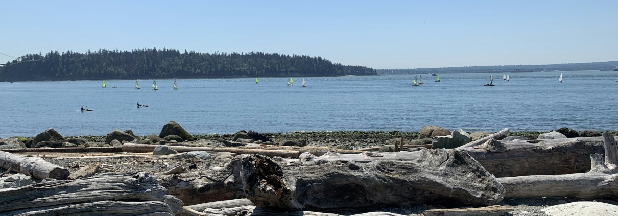
Most people picture Ambleside as the part of West Vancouver that never changes: the low shops along Marine Drive, the seawall, the pier, the old apartment blocks above the beach. That picture is now out of date, and the reason matters if you are buying here.
On 7 April 2026 the Province of British Columbia stepped over West Vancouver Council and imposed a new land-use plan on Ambleside’s commercial area. The District’s own zoning still caps most of the Ambleside Centre at three storeys. The plan the Province put in its place contemplates buildings of up to 14 to 16 storeys at one waterfront location.
That is the single biggest thing to understand about Ambleside right now. This guide covers it, along with the parts of the neighbourhood that do not change: the history, the streets, the housing stock and what goes wrong in it, the permits that attach to the land, the park, the schools and the buses. Every fact is linked to the authority that published it.
The short version
- Ambleside is West Vancouver’s town centre, and has been its main shopping area since at least the 1950s. The District’s own planning history records that in 1956 Ambleside was the largest shopping district in West Vancouver.
- It is old, dense and grey-haired by West Vancouver standards. A District community profile from 2017 found 7,500 residents, 18% of West Vancouver’s population, with almost half of them over 65 and 74% of dwellings built before 1980.
- There are already more than 80 buildings over four storeys here, most of them between five and nine. Ambleside is not a single-family neighbourhood.
- The Province overrode Council on 7 April 2026 and adopted the Ambleside Centre Local Area Plan into the Official Community Plan. Existing zoning allows three storeys in the Ambleside Centre; the adopted plan contemplates up to 14 to 16 storeys in one spot and 10 to 12 in several others.
- West Vancouver has still not adopted its small-scale multi-unit housing bylaw. The provincial deadline passed on 30 June 2026. Do not assume you can put three, four or six units on a lot here yet.
- Four different development permit areas can attach to a property here — watercourse, foreshore, wildfire and difficult terrain. Each one is a report and a permit before you can build.
- No price figures appear on this page. Ambleside spans everything from a small one-bedroom in a 1960s block to a waterfront house, so a single number would mislead you. Current benchmarks are on the North Shore market statistics page.
On this page
- Where Ambleside is, and which city hall
- A short history, from steamer landing to town centre
- The streets, and how the pockets differ
- What kind of money Ambleside is
- The housing stock, and what goes wrong in it
- The plan the Province imposed in April 2026
- Small-scale multi-unit housing: not settled here yet
- Land, water and fire: the permits attached to the ground
- What to check before you buy in Ambleside
- Daily life on the Marine Drive strip
- The park, the beach and the seawalk
- Schools
- Getting around
- What is being built and planned
- What people here like, and what they complain about
- Who Ambleside suits, and who should look elsewhere
- Questions people ask
Where Ambleside is, and which city hall
Ambleside sits on the north shore of Burrard Inlet in the District of West Vancouver, just west of the Lions Gate Bridge and Park Royal. BC Geographical Names records it as a community on the north side of Burrard Inlet in West Vancouver, adopted as a place name on 21 November 1961.
Ambleside has no legal boundary. It is a community name, not a municipal ward, and the District’s own plans define their study areas by maps rather than by street lines. In practice the name covers the flat blocks between Marine Drive and the water, the shopping strip on Marine Drive itself, and the apartment blocks on the slope just above.
Your city hall is the District of West Vancouver, not the City or District of North Vancouver. This trips up buyers constantly, because the three North Shore municipalities have different zoning, different permit rules and different fees. Municipal Hall is at 750 17th Street, open 8:30 a.m. to 4:30 p.m., Monday to Friday. The main line is 604-925-7000 and the general address is on the District’s contact page.
Two numbers are worth saving before you make an offer on anything here: Planning and Development Services on 604-925-7055, and Permits and Inspections on 604-925-7040. Everything municipal in this guide can change, so call or email them and confirm the position on the specific address you care about.
A short history, from steamer landing to town centre
The name is borrowed from England. BC Geographical Names records that Ambleside was “Named by Mr. Morris Williams, a tailor, who arrived here 1912 and resided in this part of West Vancouver; Williams formerly lived in the English Lake District, and Ambleside was a town at the head of Lake Windermere, Westmoreland.”
Before there was a road there was a boat. The same record notes that Ambleside was previously listed as a steamer landing, and that this was the West Vancouver ferry terminus. The District of West Vancouver was incorporated on 15 March 1912, “taking jurisdiction over what had been a part of the District of North Vancouver”.
Ferry service across the inlet began in 1909 and the new municipality took it over. The District’s heritage page for the Ferry Building records that “Ferry service to West Vancouver was first established in 1909 as a private business by John Lawson”, that the municipality then took over the service “and built this structure in 1913”, and that the building was designated as heritage in 1987. It now houses a municipal art gallery at 1414 Argyle Avenue.
One building here predates all of that. Navvy Jack House at 1768 and 1770 Argyle Avenue was “built circa 1872” and is, in the District’s words, the “oldest surviving known building on the North Shore of Burrard Inlet, and one of the oldest in the Province”. Council has given it municipally designated heritage status, and permits for its restoration were approved in December 2024.
Two things then reshaped the area. The Guinness family, having bought much of the upper slopes, “built the Lions Gate Bridge” in 1937 and 1938 “to provide the first fixed crossing to Vancouver, and later built the Capilano Golf Course and the north part of Park Royal, one of the first shopping centres in Canada, in the 1950s”, according to the District’s heritage page. Then, in 1959, 20 hectares of land were rezoned, “permitting dozens of high-density apartment buildings to be constructed in Ambleside and Hollyburn”. The Crescent Apartments, in 1961, was West Vancouver’s first high-rise.
The town-centre role grew rather than being declared. The District’s own Ambleside planning history describes Ambleside as “an early subdivision built on a gridiron plan with a commercial strip along Marine Drive”, and records that “In 1956, Ambleside was the largest shopping district in West Vancouver, with a larger commercially zoned area” than Park Royal or Dundarave. Policy language calling it the Town Centre appears from the 1980 Official Community Plan onward.
The streets, and how the pockets differ
Ambleside is built on a grid, which is unusual for the North Shore and is the reason it walks so well. The streets run in four bands, and they behave very differently.
Argyle Avenue and the waterfront
Argyle is the bottom street, between the railway and the beach. It holds the Ferry Building Gallery, the Silk Purse, Navvy Jack House and a shrinking number of private homes. The District has been buying those homes for fifty years to turn them into park, which is covered further down. If you are looking at anything on Argyle, the foreshore permit rules matter more here than anywhere else in West Vancouver.
Bellevue and Marine Drive
Bellevue Avenue and Marine Drive carry the commercial core. Marine Drive is the shopping street; Bellevue, one block down, mixes apartments with a few commercial sites. Both are named in the new Ambleside Centre Local Area Plan, and both are where the storey limits changed in April 2026.
The apartment blocks above Marine Drive
Duchess, Fulton, Haywood, Esquimalt, Inglewood, Gordon, Kings, Queens, Lawson and Jefferson Avenues run east to west above the strip. This is where most of Ambleside’s population actually lives, in low and mid-rise apartment buildings, and it is the band the District calls the Ambleside Apartment Area. Bylaw amendments for that area were adopted in July 2024, ahead of the commercial plan.
Clyde Avenue and the eastern edge
Clyde Avenue, at the eastern end, is a separate animal again: a light commercial and service street with its own development permit designation in the Official Community Plan. It is the least residential part of Ambleside and the closest to Park Royal.
What kind of money Ambleside is
There are no prices on this page, deliberately. Ambleside covers an unusually wide range for one neighbourhood: small one-bedroom apartments in 1960s walk-ups, large newer condominiums, duplexes on the side streets, older houses on the flat, and waterfront property on Argyle. Quoting one figure for “Ambleside” would tell you almost nothing useful.
What is fair to say is this. Ambleside is the part of West Vancouver where it is still possible to buy an apartment rather than a house, and it is where the District’s own oldest and densest housing sits. Compared with West Vancouver’s upper slopes it is the accessible end of the municipality. Compared with most of the North Shore it is not cheap.
For current numbers, use the monthly benchmarks from Greater Vancouver REALTORS® rather than any agent’s summary. They are kept up to date on the North Shore real estate market statistics page.
What actually decides the price here
- How much water you can see, and from which floor. In a neighbourhood this flat, the view comes from height, and the view is what people pay for.
- Whether the building in front of you can grow. This changed in April 2026, and it now matters more than it did.
- Walking distance to Marine Drive. The strip is the point of living here. Blocks that need a car to reach it lose the advantage.
- Which side of the railway you are on. Argyle Avenue and the waterfront blocks have train noise and level crossings that the slope does not.
- In an apartment, the building’s age and its depreciation report. Most of Ambleside’s blocks are 50 or 60 years old, and the state of the envelope, pipes and reserve fund moves the price more than the finishes do.
The housing stock, and what goes wrong in it
The District’s 2017 Ambleside community profile, summarised in its Ambleside planning history, found that Ambleside “had the oldest housing stock, greatest variety in housing options in West Vancouver” and that “74% of dwellings constructed prior to 1980, reflecting that most of the apartment area buildings were constructed in the 1960s and 1970s”.
That age profile tells you what to look for. These are the things that come up repeatedly in buildings and houses of this vintage on the North Shore.
- Building envelopes. Buildings from the 1960s and 1970s were built before rainscreen construction became standard. Ask whether the envelope has been renewed, when, and what it cost. Our guide on rainscreen work and leaky-condo repairs explains what the paperwork should show.
- Plumbing and wiring. Older stock can carry original galvanised or copper supply lines, polybutylene in later renovations, and in houses, cloth-sheathed or aluminum wiring. All are insurable and fixable, but they affect your quote and your inspection.
- Windows and sound. Single glazing is common in unrenovated apartments here, and Marine Drive is a busy street.
- Parking. Buildings from this era were designed for fewer cars per unit than people own now.
- Reserve funds. A 60-year-old building with a thin contingency fund is a special levy waiting to happen. Read the depreciation report, not just the minutes.
- Oil tanks, in the houses. Homes built before the 1960s on the North Shore were often heated by oil, and a buried tank is the buyer’s problem once the deal closes. See our guide to buried oil tanks.
Our general checklist for older North Shore homes covers the rest. None of this is a reason to avoid Ambleside. It is a reason to buy with a report in your hand.
The plan the Province imposed in April 2026
This is the part of Ambleside that no older guide will tell you, and it changes what you are buying.
British Columbia set housing targets for 30 municipalities in September 2023. West Vancouver’s target was 1,432 housing units, described by the Province as “net new units to be completed within five years”. In July 2025 the Province added three specific directives, one of which was to adopt the proposed Ambleside Centre Local Area Plan by 31 December 2025.
That did not happen. The Province’s own news release of 7 April 2026 states that “The district did not complete any of the directives by the Dec. 31, 2025, deadline, limiting development opportunities in the Ambleside and Park Royal-Taylor Way areas”, and that West Vancouver had built “only 58 units of the 220 units target” in year one.
So the Province acted itself. The District’s own notice records that “On April 7, 2026, the provincial government issued an Order in Council, which amended the Official Community Plan by adopting the Ambleside Centre Local Area Plan (LAP), for the Ambleside Commercial Areas. The adopted LAP is the version that was presented to Council in May 2025.” The District confirms on its Ambleside Local Area Plan page that the plan “has been adopted as a result of a Provincial Order in Council and now forms part of the District’s OCP”.
What the plan allows, against what the zoning allows
This contrast is the useful part. West Vancouver’s Zoning Bylaw No. 4662, 2010 still says of the AC1 Ambleside Centre zone that “No building shall exceed 3 storeys, nor 11.3 metres measured from the average elevation”, rising to “4 storeys, and 14.3 metres” only where specific lot conditions are met.
The Ambleside Centre Local Area Plan that the Province adopted sets out much more, by sub-area. Its own words, area by area, include:
- The low-rise areas: “Up to 1.75-2.0 FAR and 3-4 storeys with commercial at street-level.”
- One waterfront area: “up to 3-4 storeys fronting Marine Drive; up to 5-6 storeys fronting 16th Street; up to 14-16 storeys fronting 17th Street.”
- Another waterfront area: “Up to 3.5-4.0 FAR and 10-12 storeys, with commercial or community use at street-level.”
- An upslope area: “up to 2-3 storeys fronting Marine Drive; up to 6-8 storeys fronting 14th Street; up to 12-14 storeys roughly centered.”
- Two further upslope areas: “Up to 3.5-4.0 FAR and 10-12 storeys, with commercial at street-level.”
The plan also requires ground-floor retail — “Require street-level commercial use on all sites unless otherwise specified” — and asks for better sidewalks and wayfinding between Marine Drive and the waterfront.
Two honest limits on all of this. First, the plan states no total number of new homes; the figure that circulates, 1,000 to 1,200 net new dwellings, is a Council direction recorded on the District’s consultation page, not a promise in the adopted plan. Second, the plan defines its own boundary by a map, not by street names, so whether a particular property is inside it has to be checked with the District.
What it means for a buyer is simple enough. A low building across the street from you is no longer a permanent view. If an outlook is part of why you are buying, read our note on what actually protects a view, and ask the District what the plan designates for the sites around you before you write an offer.
Small-scale multi-unit housing: not settled here yet
Across most of British Columbia, provincial law now requires municipalities to allow three to six homes on a lot that used to take one house. West Vancouver has not finished doing it, and this is a live trap for buyers.
The District’s own small-scale multi-unit housing page states plainly that “The Provincial deadline to comply and update our bylaws was June 30, 2026.” Council gave first, second and third readings to a modified amendment bylaw on 21 September 2026, and the bylaw “has…been referred to the Ministry of Transportation and Transit (MoTT), whose approval is required prior to Council consideration of fourth reading and adoption.”
The unit counts the District proposes are these, in its own table:
- A parcel under 280 m²: 3 units.
- A parcel of 280 m² or more, and more than 400 m from a prescribed bus stop: 4 units.
- A parcel of 281 m² or more, and 400 m or less from a prescribed bus stop: 6 units.
Some land is exempt by provincial law. The District notes that section 481.4 of the Local Government Act exempts land that is protected by heritage designation, is larger than 4,050 m², or is not served by municipal or regional water or sewer.
Two cautions. Until that bylaw is adopted, do not pay for redevelopment potential you cannot yet use. And much of Ambleside is already zoned for apartments or commercial use, so these rules would only reach the parts still zoned for single-family or duplex. If a listing is being sold to you on a multiplex idea, ask the District’s planning department what the zoning on that exact parcel permits today. Our guide on how many homes you can build on a lot explains how the rules fit together.
Land, water and fire: the permits attached to the ground
West Vancouver attaches development permit requirements to land by hazard, not by neighbourhood. Four of them can catch an Ambleside property, and each one means a report by a qualified professional before a permit. A development permit area, or DPA, is simply a mapped area where extra rules apply.
Watercourses. The District’s environmental development permit page defines a watercourse as “A creek, pond, lake, river, stream, or brook, whether usually containing water or not and any spring or wetland that is integral to a watercourse.” In existing neighbourhoods, “Any proposed development within 15 m of the top of bank of a watercourse will require an Environmental Development Permit.” Note that “Development includes the topping, limbing or removal of hazard trees” — so tree work can need a permit too. The District says these permits typically take four to six weeks.
The foreshore. This is the one that bites on Argyle Avenue. The foreshore development permit area “was adopted on April 11, 2022” and covers “Waterfront properties and upland properties below the FCL…which are potentially at risk to coastal flooding.” A permit is required if you plan “to build a new house, or subdividing the land, or are planning any development including tree work within 15 m of the natural boundary (high tide mark) of the ocean”. The purpose is to “Minimize risk to people and property from coastal hazards including sea level rise, storms, wave effects, and flooding.”
Wildfire. The wildfire hazard development permit area was “approved by Council on December 14, 2020” and covers “all properties within 100 metres of a forested area—approximately 50% of land in the District.” It bites on building or subdividing, and requires a Wildfire Hazard Assessment Report from a qualified professional, a survey, architectural drawings showing exterior materials, and a landscaping plan.
Steep ground. The Official Community Plan’s designation for sites with difficult terrain covers “any situation where construction might occur on slopes exceeding 35% and/or where driveway grades cannot be provided at less than 20%”. Most of Ambleside’s flat blocks would not reach that, but the upper edge of the neighbourhood can.
Whether a specific address is caught by any of these is a mapping question, and the answer is not on a web page. Ask Planning and Development Services on 604-925-7055 with the address in front of you.
What to check before you buy in Ambleside
| What to check | Why it matters here | Where to check it |
|---|---|---|
| What the Ambleside Centre plan designates for the sites around you | A three-storey neighbour can become a taller building; the plan the Province adopted goes well beyond existing zoning | District Planning and Development Services, 604-925-7055 |
| Whether your parcel is inside the plan’s boundary at all | The plan uses a map, not street names, so “in Ambleside” is not the same as “in the plan” | The same planning department, with the civic address |
| Which development permit areas touch the property | Watercourse, foreshore, wildfire and difficult-terrain permits each add a professional report and weeks of time | District Planning; permits and inspections on 604-925-7040 |
| Current zoning on the parcel, today | The small-scale multi-unit housing bylaw is not adopted, so extra-unit potential is not yet a given | District Planning; the District’s SSMUH page |
| In an apartment, the depreciation report and envelope history | Most Ambleside buildings date from the 1960s and 1970s; 74% of homes here predate 1980 | The strata’s records; see our depreciation report guide |
| Permit history on a house or a renovated suite | Unpermitted work on old stock becomes your problem at completion | How to check permit history, then the District |
| School catchment for the exact address | Ambleside sits near several schools; proximity is not catchment | West Vancouver Schools, 604-981-1000 |
| Railway proximity on the waterfront blocks | Argyle and the lower blocks sit beside an active rail line | Visit at different times of day before you offer |
Daily life on the Marine Drive strip
Ambleside’s shopping is on Marine Drive, in a strip of low buildings with shops at street level. It is a working high street rather than a destination: groceries, pharmacies, banks, restaurants, salons and services, most of them independent. The businesses organise themselves through the Ambleside Dundarave Business Improvement Area, which the District describes as “a defined commercial area, where local business and property owners work together to promote the area to increase customer traffic”.
Shops change. Rather than list names that may not be there when you read this, walk the four blocks between roughly 14th and 18th Street on a weekday morning and see it for yourself. That short walk tells you more about whether Ambleside suits you than any description.
The other half of daily life here is civic. The West Vancouver Memorial Library is at 1950 Marine Drive, phone 604.925.7400, open Monday to Thursday 10 a.m. to 8 p.m. and Friday to Sunday 10 a.m. to 6 p.m. at the time of writing. The library describes its own position as across the street from Memorial Park and just east of the Community Centre.
The West Vancouver Community Centre and Aquatic Centre is next door and holds the pools, a leisure pool, a water slide, a sauna and steam room and a fitness centre. Its posted fall hours are Monday to Friday 5:30 a.m. to 9 p.m., Saturday 6 a.m. to 9 p.m. and Sunday 8 a.m. to 9 p.m. Recreation enquiries go to 604-925-7270. The Seniors’ Activity Centre is a short walk away on 21st Street, which matters in a neighbourhood where the District found almost half of residents were over 65.
Ambleside is also where West Vancouver keeps its arts buildings. The District’s planning history notes that “Ambleside is home to three of the District’s current dedicated arts and culture facilities (Art Museum, Music Box, and Silk Purse).” The Ferry Building Gallery at 1414 Argyle Avenue runs up to eleven exhibitions a year. The Silk Purse Arts Centre at 1570 Argyle Avenue “was built as a summer cottage in 1925 and subsequently converted for year-round residential use” and is now home to the West Vancouver Arts Council.
The summer set piece is the Harmony Arts Festival on the waterfront, presented by Odlum Brown. In 2026 it ran from 31 July to 9 August. In June the District also runs the West Vancouver Community Cultural Fest, which it calls “a free two-day festival in West Vancouver that celebrates food, music and culture from around the world”, at Ambleside Park at the foot of 13th Street. Dates move, so check the District’s events listing.
The park, the beach and the seawalk
Ambleside Park is what most people come here for. The District calls it “West Vancouver’s gateway park”, and the entrance “is located at the foot of 13th Street”. What is actually in it, in the District’s own list: a concession, parking, picnic tables, public washrooms with change rooms, a playground, the pond, sports fields, a basketball court, a skatepark, a fitness circuit, tennis courts, two bocce courts — one sand, one turf — and a pollinator garden. Four dedicated pickleball courts sit on the gravel field parking area behind the ball diamond.
You can swim. The park “has sandy beaches and a designated swim area monitored by lifeguards in the summer”, with an outdoor shower beside the concession washroom building. The District does not publish the exact lifeguard season, so check before you rely on it.
There is an 18-hole pitch and putt inside the park. Ambleside Par 3 is at 900 Par 3 Road, phone 604-922-3818, and the District says it “is open daily from 9 a.m. to 6 p.m.”
Two practical warnings that surprise people who move here.
- Ambleside is not an off-leash park. The District’s dogs in parks page lists 14 off-leash areas and Ambleside Park is not one of them. Here, “Dogs are allowed on a leash (no greater than two metres in length) on paved footpaths”, and dogs are not allowed on grass, piers, playgrounds, beaches or gravel paths. Further along, the dog path behind the fence between 19th and 24th Street is off-leash.
- Dogs are banned outright from John Lawson Park. The District’s rule is that “Dogs are not permitted in any area of John Lawson Park and Millennium Park” — and those are the two parks right beside the pier and the festival site.
There is also a parking contradiction worth knowing. The Ambleside Park page says pay parking is in effect year-round; the Par 3 page advertises “Plenty of free parking at Ambleside Park”. Assume you pay, and use the District’s own page as the authority.
John Lawson Park, at the foot of 17th Street, is the other half of the waterfront: the pier, a splash pad, a playground with a pirate ship, sheltered picnic tables, and washrooms open year-round from 6 a.m. to 10 p.m. The District notes that “in 1872, Navvy Jack Thomas, West Vancouver’s first non-native resident, built his home here”. Parking is limited and “fills up quickly in good weather”.
Walking west from there, the District says, “The popular 1.7-kilometre Centennial Seawalk extends from the bottom of 18th Street to Dundarave Park.” Bikes, boards and rollerblades are not permitted on it. The longer Spirit Trail is a separate project: the District describes it as “an accessible greenway that will eventually extend from Horseshoe Bay in West Vancouver to Deep Cove in the District of North Vancouver” — note the future tense. It is not finished.
Schools
Ambleside is in School District 45, West Vancouver Schools. Proximity is not catchment. Living across the road from a school does not guarantee a place in it, and catchment boundaries change. Confirm the catchment for the exact address with the district before you buy, on 604-981-1000.
Hollyburn Elementary is the school the district itself places in the neighbourhood, describing it as “Situated in the picturesque seaside community of Ambleside”. Its original structure was “built in 1913” and, in the district’s words, “combines the charm of a heritage building with the functions of a modern facility”. It runs Kindergarten to Grade 7.
Ridgeview Elementary, on the slope above, is also Kindergarten to Grade 7 and describes itself as “a Kindergarten to Grade 7 school with a long tradition of excellence in Academics, Athletics, and the Fine Arts”. École Pauline Johnson, to the west, is Kindergarten to Grade 7 and offers the district’s “Early and Late Immersion Programs” in French.
For secondary, West Vancouver Secondary covers Grades 8 to 12. The school states that it “is an IB World School”, meaning it offers the International Baccalaureate. It also runs a Pursuit programme for provincially or nationally ranked athletes and high-calibre performing artists, a basketball academy, and applied skills programmes in wood working and carpentry. It does not advertise Advanced Placement.
One thing parents moving from another district should read. West Vancouver Schools’ admissions guidelines say the district “encourages students to attend their catchment area school, while also enabling students and their families to make choices to attend other schools in the district”, but that “The placement of a student in a school will be dependent upon the availability of space, programs and resources.” In-catchment students with siblings already at the school come first, then in-catchment students, and within each group applications are ranked by the “time/date stamp of application form submission, earliest first”. If you are counting on a particular school, apply early.
There is also an independent school in the neighbourhood, St. Anthony’s on Keith Road. Collingwood and Mulgrave, the two independent schools people usually name in connection with West Vancouver, are both well up the hill and are not in Ambleside.
Getting around
Ambleside’s buses are run by West Vancouver’s own municipal transit service, the Blue Bus. The District’s bus schedules page says simply that “West Vancouver Transit is part of the regional TransLink system” and sends riders to TransLink for current times. Its own transit information line is 604-985-7777, Monday to Friday 9 a.m. to 5 p.m.
Three routes matter most if you live here, using TransLink’s own current names for them. The 250 “Horseshoe Bay/Dundarave/Vancouver” is the downtown bus. The 253 “Caulfeild/Vancouver/Park Royal” and the 255 “Dundarave/Capilano University” both work the Marine Drive corridor and connect Ambleside east towards Park Royal and the rest of the North Shore.
TransLink’s current timetable for the 250, effective 7 September 2026, describes it as running “From Horseshoe Bay Ferry Terminal via Keith Rd, Bay St, Nelson Ave, Marine Dr, Lions Gate Bridge, Stanley Park Causeway, Georgia St to Homer.” It runs along Marine Drive through Ambleside and over the bridge without a transfer, which is the real transit advantage of living here.
A caution about journey times. TransLink publishes no timepoint in Ambleside itself. The West Vancouver timepoints on the 250 timetable are Marine Drive at 25th Street, which is in Dundarave, and Park Royal. Ambleside stops sit between the two, so any single “Ambleside to downtown” figure you see quoted has been estimated by somebody. Put your own stop and your own departure time into the TransLink trip planner instead. Times also swing a long way between the morning off-peak and the afternoon peak over the Lions Gate Bridge.
Park Royal, a few minutes east, is the transfer point for the rest of the North Shore, and since 7 September 2026 it has been the western end of TransLink’s R2 Marine–Willingdon RapidBus, which TransLink says “now provides a direct, one-seat ride between Park Royal and Metrotown”, with “Buses every six to seven minutes during peak periods”. Be clear about what that does and does not mean: the R2 starts at Park Royal and runs east through North Vancouver. It does not run west along West Vancouver’s Marine Drive through Ambleside.
There is no SeaBus on this side. TransLink’s SeaBus runs between Waterfront downtown and Lonsdale Quay in North Vancouver only, so from Ambleside the SeaBus means a bus east first.
What is being built and planned
Beyond the new Ambleside Centre plan, the change that will be most visible on the ground is the waterfront park.
The District has been quietly assembling the Argyle Avenue waterfront for half a century. Its Ambleside Waterfront Park Implementation Project page records that the District has bought 32 properties on the Ambleside waterfront since 1975, and that on 31 March 2025 it acquired 1444 Argyle Avenue — the final home on the Ambleside waterfront. The project will “implement changes outlined in the Ambleside Waterfront Concept Plan, in phases, over the next several years”, linking John Lawson Park, Millennium Park, Brissenden Waterfront Park and Ambleside Green. The District is candid that it “will be built in sections and will likely take several years to realize.”
Individual projects come and go. A proposal for a nine-storey mixed-use building at 1763 Bellevue Avenue, for example, is now archived on the District’s development application pages: in February 2021 Council decided it “may only advance upon completion of the Local Area Plan”. Check the District’s active applications list for what is live today. The restoration of Navvy Jack House is also under way.
If you want to know what is proposed next to a specific property, the District’s active development applications list is the place to look, and planning staff will tell you what is in the queue.
What people here like, and what they complain about
The case for Ambleside is easy to state. You can live without a car. The grid, the shops, the library, the community centre, the beach and the seawalk are all inside a few blocks, which is rare anywhere on the North Shore and almost unique in West Vancouver. There is a real apartment market, so it is possible to buy in here without buying a house. And one bus reaches downtown.
The complaints are as consistent as the compliments.
- The bridge. Everything driving south crosses the Lions Gate Bridge, and it is a three-lane crossing. Afternoon peak times are genuinely bad.
- Empty shopfronts and slow change on Marine Drive. Ambleside has been the subject of District planning studies since 1946, and the strip has been the subject of “what should Ambleside be” debates for decades. The Province’s April 2026 order is the latest chapter of exactly that argument.
- Parking. Pay parking at the park year-round, limited parking at John Lawson Park, and older apartment buildings with fewer stalls than residents have cars.
- Ageing buildings. With 74% of homes built before 1980, special levies and envelope projects are a normal part of strata life here.
- Height, and the argument about it. Some residents want the new density; others fought it hard enough that the Province had to impose the plan. Whichever side you are on, expect construction and expect disagreement about it.
- Dogs. Genuinely restrictive by North Shore standards, as set out above.
Who Ambleside suits, and who should look elsewhere
It suits people who want to walk to everything, downsizers leaving a large West Vancouver house but staying in the municipality, buyers who want a West Vancouver address at apartment prices, retirees who value the library, the community centre and the Seniors’ Activity Centre within a few blocks, and anybody who commutes downtown by bus rather than by car.
It suits less well if you want a quiet cul-de-sac and a big flat yard, if a permanent unobstructed view is essential to you, if you need a dog to run off-leash close to home, if you drive south across the bridge at peak times every day, or if you are buying specifically to add units to a lot and need certainty about that today.
If you are weighing Ambleside against its neighbours, Dundarave is quieter and smaller-scaled at the west end of the same seawalk; Park Royal and the Taylor Way corridor are closer to the bridge and are the other area under a provincial housing directive; and across the Capilano River, Lower Lonsdale offers a comparable walkable, apartment-heavy waterfront in a different municipality with the SeaBus.
Questions people ask
Is Ambleside in North Vancouver or West Vancouver?
West Vancouver. It is a District of West Vancouver neighbourhood, so its zoning, permits and taxes come from West Vancouver’s Municipal Hall at 750 17th Street, not from either North Vancouver municipality.
Are towers coming to Ambleside?
Taller buildings are now contemplated in the plan the Province adopted on 7 April 2026. The plan’s own wording allows “up to 14-16 storeys fronting 17th Street” in one waterfront area and 10 to 12 storeys in several others, against existing AC1 zoning that caps most of the Ambleside Centre at three storeys. A plan is not a building permit, and nothing has been built to those heights. But the possibility is now in the Official Community Plan, and it applies site by site, so ask the District about the sites around the one you are considering.
Can you swim at Ambleside Beach?
Yes. The District says Ambleside Park “has sandy beaches and a designated swim area monitored by lifeguards in the summer”. It does not publish the lifeguard season dates, so check before you count on supervision.
Can I take my dog to Ambleside Beach?
Not onto the beach. Dogs are allowed on a leash no longer than two metres on the paved footpaths in Ambleside Park, and are not allowed on grass, piers, playgrounds, beaches or gravel paths. They are banned from John Lawson Park entirely. The nearest off-leash stretch is the dog path behind the fence between 19th and 24th Street.
How long does it take to get downtown from Ambleside?
The 250 runs from Ambleside over the Lions Gate Bridge to Georgia Street without a transfer. TransLink does not publish a timepoint in Ambleside, so rather than repeat somebody’s estimate, put your own stop and your own travel time into the TransLink trip planner. The spread between an off-peak morning trip and the afternoon peak is large.
Can I build a fourplex on a lot in Ambleside?
Do not assume so. West Vancouver has not yet adopted its small-scale multi-unit housing bylaw; the provincial deadline was 30 June 2026 and the bylaw is with the Ministry of Transportation and Transit for approval. Much of Ambleside is also already zoned for apartments or commercial use rather than single-family, so the rules would not reach it in the same way. Ask the District’s planning department what your specific parcel allows today.
Is Ambleside a good place to buy?
That depends entirely on what you want, which is why this page has a “who it suits” section rather than an opinion. What is true is that Ambleside is the most walkable part of West Vancouver, has the municipality’s oldest housing and its widest range of housing types, and is in the middle of the biggest land-use change in its recent history. All three of those facts should shape the questions you ask about a specific property.
Thinking about a specific address in Ambleside?
Send me the address and I will pull what is actually on file before we talk: the sale history, the strata documents and depreciation report if it is an apartment, the permit history, and what the District says is planned for the sites around it. That last one matters more in Ambleside this year than it has in a long time.
Thinking about buying or selling in Ambleside?
Leave your name and number and I will come back to you, usually the same day. Tell me the address if you have one and I will pull the sale history and the documents that matter before we talk. No charge, no obligation.
Prefer to talk now? Call or text 778-903-7306.
فارسی: این راهنما به فارسی هم موجود است — راهنمای امبلساید، وست ونکوور.
Strata buildings near Ambleside
The 12 closest of 32 buildings on my list. Each page shows the homes for sale there right now.
Read next
- North Shore real estate market statistics — the current benchmark prices, updated monthly
- Older North Shore homes: what to check — the right checklist for Ambleside’s 1960s and 1970s stock
- Rainscreen and leaky-condo repairs on the North Shore — what the envelope paperwork should show
- How to read a strata depreciation report — the document that predicts your special levy
- What actually protects a view — relevant now that Ambleside’s height limits have changed
- All of Tom’s North Shore neighbourhood and buyer guides
Disclaimer. This page is general information about a neighbourhood, not advice about any specific property, and not legal, tax or engineering advice. Municipal rules, development plans, zoning, school catchments, transit schedules, facility hours and market conditions all change, sometimes quickly. Nothing here tells you what any individual property is worth or what may be built beside it. Confirm the current position with the authority that owns it: the District of West Vancouver (604-925-7000; planning 604-925-7055; permits and inspections 604-925-7040), West Vancouver Schools (604-981-1000), TransLink, the Province of British Columbia, or your strata corporation. Take advice from a lawyer, notary, home inspector or geotechnical engineer before you commit money. Every fact here was checked against the linked sources on 26 September 2026. Last reviewed: September 2026.
Run your Ambleside numbers before you make an offer
Three figures decide what you can actually buy here, and all three use 2026 BC rates.
- Mortgage and stress test — what a lender will actually approve
- Property transfer tax — 2026 rates and the exemptions
- Closing costs — what you need on top of the deposit
- Strata fees — what the monthly figure really covers

Tom Jahed, REALTOR®
Vanak Realty, North Vancouver. Ten years in North Vancouver real estate and more than 400 transactions closed, including pre-sales. Works in English and Farsi.
Written by Tom Jahed, licensed REALTOR®, Vanak Realty, North Vancouver.